Planning
Skiing
Skimo.co doesn’t provide significant beta but mentions:
If there is sufficient snow coverage, you can actually ski some steep lines on the S face of Eldorado as well! The E ridge is the classic line, of course, and has amazing views and position looking down towards Moraine Lake.
How we get down will need to be a day of decision. Fortunately we will be climbing our ski line making decision making easy.
Beta
Climbing
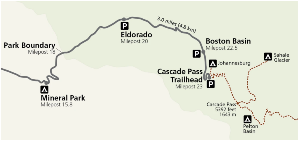
There is a decent amount of Beta on Eldorado Peak. Skimo.co provides an excellent guide on the route. The start of the day will likely start at mile marker 18 on Cascade River Road.
Their guide claims the crux of the climb is actually the river crossing at the beginning. They recommend we scout this portion of the climb out, but unfortunately time isn’t going to allow for this.
Looking at Strava’s weekly heat map it shows activity going up the route. It looks like it follows the described route exactly. I don’t expect any concerns going up the standard route.
“Once across the river, you will find a well-defined climbers trail that will take you all the way up to a clearing around 4,600′, where you will enter a large boulder field. Early in the season, you will likely put on your skis here, as the boulders will be sufficiently covered in snow to allow for skinning. Later in the season, though, you may need to posthole your way through the boulder field up to around 5,200′.”
Reviewing the route on Caltopo the most difficult route finding will likely be finding the notch to move from the boulder field to under the Eldorado glacier. Skimo.co has this to say.
Continue climbing up towards the ridgeline on climbers left. You are looking to cross over around 6,200′ in a prominent notch that will take you across E to the Roush Creek drainage. Once across, you will climb the gradual slopes of the Eldorado Glacier up towards the peak itself. Stay to climber’s left of the Eggplant, a prominent knob around 7,700′. There is often a large wind lip here that is easy to spot. Gain the east ridge from the base where the upper Eldorado Glacier converges with the Inspiration Glacier. In the early season, the ridge is fairly wide, maybe wide enough to skin at points; later in the season, however, it becomes more of a knife-edge.
Driving
Starting from the Seattle area it will take between two and a half and three hours to get to the trail head.
The national park service provides up to date road information on Cascade River Road. Currently the road is closed at mile marker 20 which means we will be able to park directly below the start of the climb. This should save significant time.
Weather
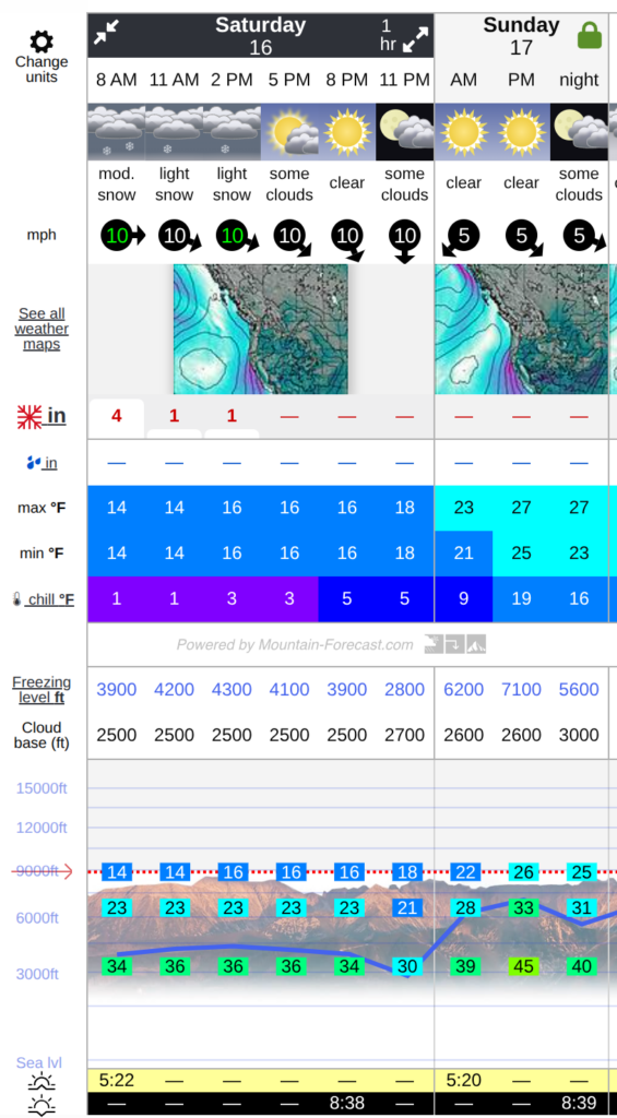
The few days leading up to the trip have been overcast with precipitation. I expect there is already fresh snow on the mountain with more coming on Saturday. Temperatures will remain below freezing on the summit on the summit with the freeze line staying below the toe of the glacier. With cool temperatures, I believe any lines not heavily impacted by wind slab or storm slab should be in!
It looks like Saturday will be a great climbing day. The forecast for the peak on the left indicates we should have clear skys all day. Weather is indicating go!
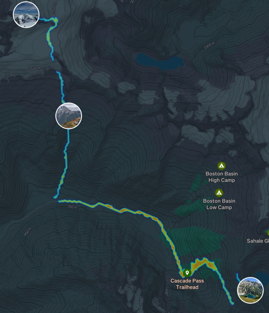
Route
I expect the route should be straight forward. Starting from the Eldorado parking lot, we will cross the North Fork Cascade River (somehow, god I hope we don’t get wet). From there, we will push straight up the mountain.
Caltopo estimates our climbing time to be ~6 hrs 45 minutes. This aligns with my This is a little longer than my 1 mph rule of thumb for skinning but maybe the glacier travel will be more complex than expected. Compromising, I think we should expect a 5 hour climb.
Based on a south aspect and temperatures, I think we shouldn’t be dropping later than 1100. A start between 0500 and 0600 should be fine.